UN
7a Silver Road
£ 190,000
Description
We don't have a Description for this property.
- Bedrooms
- 2
- Bathrooms
- 0

Leaflet © OpenStreetMap contributors
The heatmap indicates the level of crime in the area. The color of the heatmap indicates the crime severity and recency.
Metrics Year-on-Year
- Average area value
- 247,955.00 £Increased by 4.61 %
- Average area rental value
- 1,040.00 £/moDecreased by 8.05 %
- Est rental Yield
- 5.03 %Decreased by 12.22 %
- Crime Rate
- 5.00 %Unchanged by 0.00 %
from 237,025.00 £
from 1,131.00 £/mo
from 5.73 %
from 5.00 %
Nearby Schools
| Name | Type | Ofsted | Distance |
|---|---|---|---|
| George White Junior School | Academy Converter | Good | 0.49 KM |
| Magdalen Gates Primary School | Community School | Good | 0.54 KM |
| Mousehold Infant & Nursery School | Academy Converter | 0.70 KM | |
| Norwich School | Other Independent School | 0.77 KM | |
| Norwich University Of The Arts | Higher Education Institutions | 0.98 KM |
Images
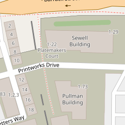
Nearby Streets
| Name | Average Price | Average Sqft | Distance |
|---|---|---|---|
| Printworks Drive | £ 345,000 | 0 | 0.00 KM |
| Silver Road Back Lane | £ 0 | 0 | 0.00 KM |
| Typesetters Way | £ 350,000 | 0 | 0.00 KM |
| Balfour Street | £ 325,000 | 0 | 0.00 KM |
| Saint Edmund's Wharf | £ 325,000 | 0 | 0.00 KM |
Nearby Transport
| Name | NLC | TLC | Distance |
|---|---|---|---|
| Norwich | 7309 | NRW | 1.20 KM |
Nearby Listings
| Address | Price | Type | Score | Distance |
|---|---|---|---|---|
| Norwich, NR3 | £ 200,000 | BUY | Unknown | 0.04 KM |
| Silver Road, NORTH CITY, Norwich, NR3 | £ 199,000 | BUY | 6 / 10 | 0.09 KM |
| Platemakers Court, Norwich | £ 250,000 | BUY | 7 / 10 | 0.10 KM |
| Platemakers Court, Printworks Drive, Norwich, Norfolk, NR3 | £ 259,950 | BUY | 7 / 10 | 0.11 KM |
| Platemakers Court, Printworks Drive, Norwich, Norfolk, NR3 | £ 240,000 | BUY | 7 / 10 | 0.11 KM |
Nearby Properties
| Address | Price | Distance |
|---|---|---|
| 3a Silver Road | £ 101,000 | 0.00 KM |
| 5 Silver Road | £ 39,500 | 0.00 KM |
| 7a Silver Road | £ 190,000 | 0.00 KM |
| 22 Silver Road | £ 172,000 | 0.05 KM |
| 28 Silver Road | £ 144,000 | 0.05 KM |